Department for Issuing Permits for Protected Areas
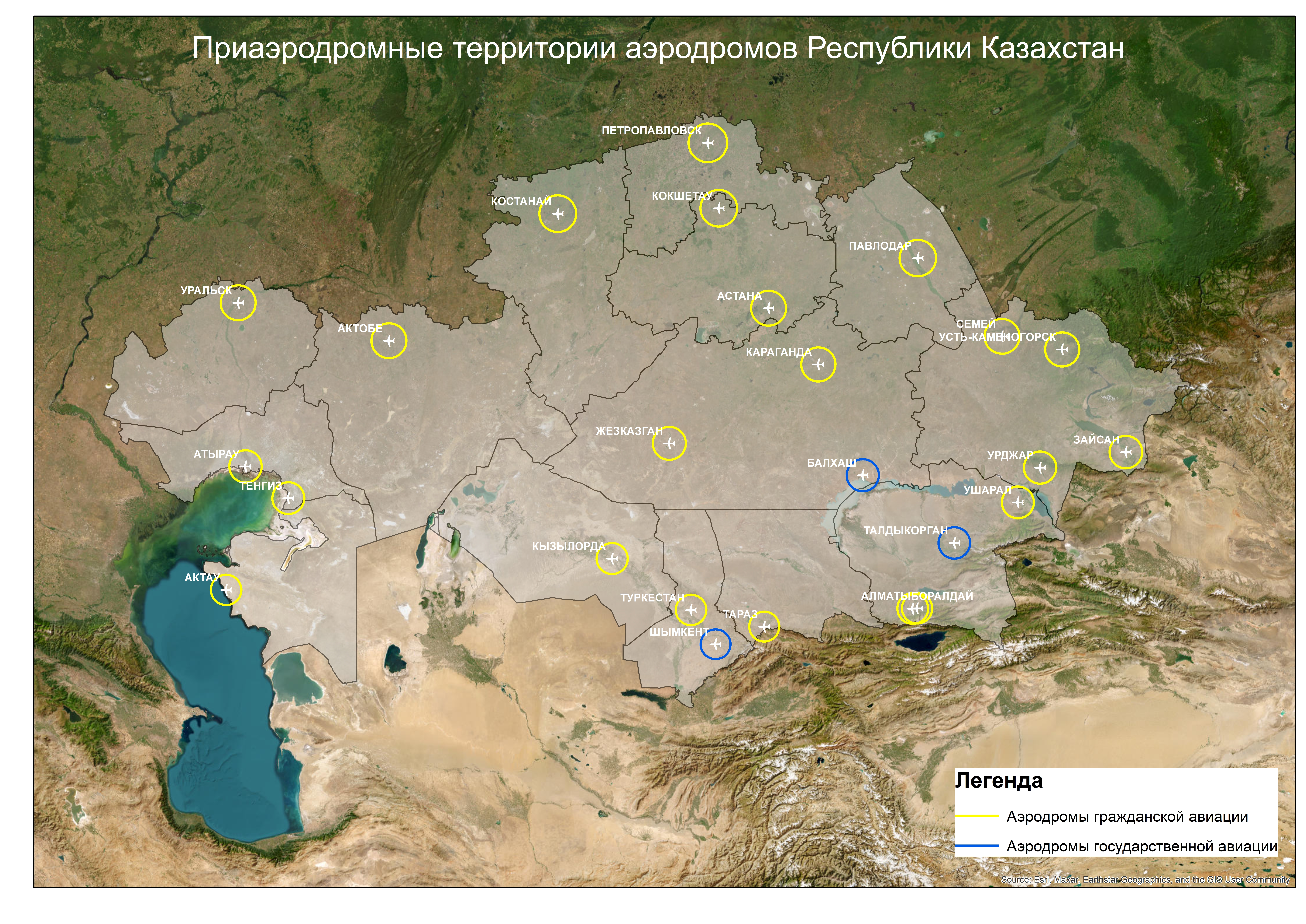
Map of Aerodrome Vicinities of the Republic of Kazakhstan

Aerodrome vicinity - an area of the earth's surface with a radius of 46 km from the aerodrome reference point (Paragraph 9, Section 1. General Provisions, Part 1. Aerodromes, Standards of Airworthiness for Civil Aviation Aerodromes (Heliports) of the Republic of Kazakhstan).
Aerodrome Reference Point (ARP) - a point determining the geographical location of the aerodrome (Paragraph 21, Section 1. General Provisions, Part 1. Aerodromes, Standards of Airworthiness for Civil Aviation Aerodromes (Heliports) of the Republic of Kazakhstan).
The coordinates of the ARP can be obtained on the website of RSE "KAZAERONAVIGATION" in the "Aerodromes" section. Select the appropriate aerodrome from the provided list, and find the information in section 2.2. "GEOGRAPHICAL AND ADMINISTRATIVE DATA OF THE AERODROME" or download the file.
Civil Aviation Aerodromes: AKTAU, AKTOBE, ALMATY, ASTANA, ATYRAU, BORALDAI, ZHEZKAZGAN, ZAYSAN, KARAGANDA, KOKSHETAU, KOSTANAY, KYZYLORDA, PAVLODAR, PETROPAVLOVSK, SEMEY, TARAZ, TENGIZ, TURKESTAN, URALSK, URDZHAR, UST-KAMENOGORSK, USHARAL.
State Aviation Aerodromes: SHYMKENT, TALDYKORGAN, BALKHASH


